Tropical Cyclone Yasi
 Wednesday, February 2, 2011 at 8:19AM
 As if Queensland hasn’t had a bad enough year already, the half of the state that was spare the flooding earlier this month is now about to be hammered by one of the largest tropical cyclones (read hurricanes, US friends) ever recorded. In this post I just want to gather together a couple of bits and pieces I’ve seen about the web. If you want to follow it as it unfolds, the best Twitter hashtag is #TCYasi and the ABC (Australia’s nationally sponsored TV network) has a live blog here.
Here’s Towsville 6hrs before the storm crosses the coast:
Here’s the predicted storm track from the Australian Bureau of Meterology. It has Mt Isa - a dusty inland mining town in the middle of nowehere, getting a Cat 1 cyclone hit, which is surely a first!
Here’s the most recent (at time of writing) WeatherChaser satellite image of Yasi. Click the image to embiggenate:
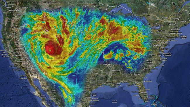
If you struggle with the scale on that image, here’s what Yasi would look like sitting over the US. It is a truly gargantuan storm. Click the image for comparisons to Asia and Europe.
Here’s the final press conference given by Queensland premier Anna Bligh before the storm comes ashore. Its quite long and raw. She starts speaking at 3:24. In it she states that the city of Townsville has lost power, which is where several evacuation centers. She also passes on a little science; talking about the unreliability of wave buoy readings off Townsville, where the buoys are being swamped by waves.


